Trails and Trail Map
A map of the trails at Merkle NRMA can be downloaded for free from this website. Please make sure to read the printing instructions and information for how to download the file to cell phones. The map is in a PDF format that requires Adobe Reader. To get the free Adobe Reader go to Adobe.com.
 Click here to view the Merkle NRMA Trail Map
Click here to view the instructions for printing and downloading the Merkle NRMA Trail Map
Click here to view the Merkle NRMA Trail Guide
To purchase copies of the Merkle NRMA Trail Guide with a credit card, please click on this link to place your order online.
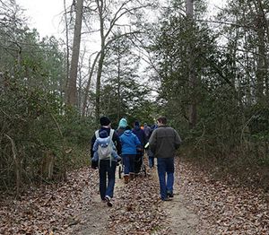 Hiking
There are four hiking trails at Merkle that explore the upland forests and marshes of the Patuxent River. Our trails are open to hikers only. Bikers and equestrians may only use the Critical Area Driving Tour. For more opportunities, visit nearby Rosaryville State Park or Cedarville State Forest. All trail distances are round-trip and measured from the Visitor Center (except Lookout Creek Trail).
Paw Paw Trail
This is a flat, family friendly trail that weaves past streams and ponds and through forests and fields. Look out for paw paw trees along the trail that grow green, oval shaped fruits. Paw paws are the largest fruit native to Maryland and were a favorite dessert of President George Washington. This trail is 1.2 miles long and is rated easy. The trail is blazed yellow.
Poplar Springs Trail
This is a relatively flat trail that connects the forested areas on either side of the main entrance road of Merkle. Named for the native poplar tree, this trail passes Merkle’s champion yellow poplar which measures 116 feet tall and nearly 17 feet in circumference. Poplar Springs is 3.0 miles long and is rated easy/moderate. The trail is blazed red.
Mounds Trail
This is a hilly trail that follows along the top of a ravine and offers views of Lookout Creek. Its most unique features are the large, man made mounds of dirt known as “ha-has” that give the trail its name. While their exact purpose is unknown, they are believed to be either early boundary markers or defenses built by soldiers during the War of 1812. This trail is 2.3 miles long and rated moderate. The Mounds Trail is blazed blue.
Lookout Creek Trail
Named for Lookout Creek which feeds into the Patuxent River, this flat, figure-eight shaped trail winds through forests and wetlands. Hikers will enjoy a beautiful view of the water and encounter various species of waterfowl and wetland vegetation. This trail is .72 miles and can only be accessed from the Critical Area Driving Tour (CADT). Lookout Creek Trail is blazed white.
