 Trail System and Maps
Over 50 miles of trails are open for hiking, horseback riding and bicycling which wind through a variety of habitat in Seneca Creek State Park. A detailed trail map can be purchased at the park office.
Mountain biking and horseback riding are very popular at Seneca Creek, and the Schaeffer Farm Trails are considered a favorite place to ride. The Maryland Park Service does not rent horses or bicycles, and only provides the trails as a means of recreation.
Seneca Creek State Park Trail Maps
New maps of the trails at Seneca Creek State Park can be downloaded for free from this website. Please make sure to read the printing instructions and information for how to download the file to cell phones. The maps are in a PDF format that requires Adobe Reader. To get the free Adobe Reader go to Adobe.com.
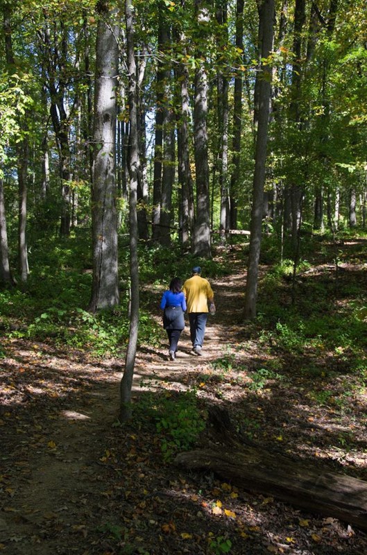 Clopper Lake Trail System
The Clopper Day-Use Area offers over a dozen miles of trails, wrapping around the lake, extending into park upland areas, and exploring the namesake creek.
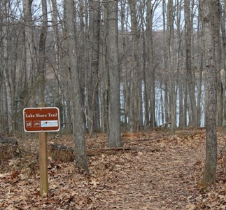
Lake Shore Trail
Blue blaze
3.7 miles - moderate
Encircling the lake, this scenic trail offers continuous views across water from woodlands or open field settings. Several streams are bridged and shore locations offer good opportunities for wildlife observations of waterfowl, herons, fish and turtles, as well as access to fishing.
The Woodlands (Clopper Lake)
No blaze
0.15 miles - easier
A short self-guided trail located adjacent to the Park Office interprets life on the “The Woodlands,” the former plantation home of the Clopper Family.
Old Pond Trail (Clopper Lake)
Red blaze
0.25 miles - moderate
Beginning near the Park Office, a short set of steps leads hikers to the Old Pond Trail. After crossing a small bridge, hikers can choose to walk left toward the park roads or right to continue through a marshy, wooded area and across a small creek. Connecting to the Great Seneca Trail from the Old Pond Trail can extend the hike.
Great Seneca Trail
Orange blaze
1.2 miles - moderate
From the parking lot near the park office, follow the Great Seneca Trail along Great Seneca Creek for a relaxing walk to hear the babbling water. The trail wanders through fields and woods, eventually leading to Clopper Lake and Long Draught Creek.
Long Draught Trail
Yellow blaze
1 mile - moderate
After parking at Kingfisher Overlook, follow the Long Draught Trail along Long Draught Creek to observe signs of beaver activity. The trail continues to a bridge crossing, where hikers have the option of continuing onto the Greenway Trail, the Mink Hollow Trail, or hiking to the Wetland area for more wildlife observation.
Mink Hollow Trail
White blaze
1.5 miles - moderate
The Mink Hollow Trail is best accessed by parking at Quail Ridge. The trail skirts the edge of the Quail Ridge parking lot just to the right of the entrance to the Bobwhite Picnic Pavilion. The trail, designed to connect with the Lake Shore and the Long Draught Trails, wanders through woods to a steep descent before arriving at a boardwalk along the marshy area of Long Draught Creek.
Schaeffer Farm Trail System
Schaeffer Farm is the hub of a trail system unique in Maryland. The trails at Seneca Creek State Park provide the backbone of a network that extends into most of the upcounty area. Configured in a series of loops, you can enjoy as few as four miles or go for an all-day adventure. It is possible to do a trail loop stretching 60 miles or more when you leave the trailhead. Linking the Seneca, Muddy Branch, and Potomac watersheds, visitors can journey from Schaeffer to Damascus to the Potomac and back. One of these larger loops has been recognized by the International Mountain Bicycling Association as one of the best and most important routes in the country.
White Loop (Schaeffer Farm)
White blaze
3.3 miles - easier to moderate
The White Loop is the gateway trail to Schaeffer Farm; all the other area trails branch off of it. Fun in either direction, it is a flowing, rolling singletrack through forest and along farm field edges. There are numerous opportunities to branch off and explore deeper into Schaeffer. At the far side of the loop there is a spur trail leading to Black Rock Mill and the Seneca Ridge and Seneca Greenway Trails.
Longer Hiking/Biking/Equestrian Trails
Seneca Greenway
Blue blaze
16.5 miles - moderate
Spanning from the C&O Canal and the Potomac River to MD-355, the Greenway provides the full panorama of Seneca Creek State Park. Due to its alignment in the floodplains of the creek, much of the Greenway is for foot-traffic only. Exceptions include the segments from Black Rock Mill to MD-28 (for hiking, biking and horses) and MD-28 to Berryville Road (for hiking and horses). The trail design allows for beautiful photography of the flowing creek waters as well as abundant wildlife observation.
Seneca Ridge Trail
Orange blaze
5.8 miles - moderate
Located in the upland areas on the south bank of Seneca Creek, the Seneca Ridge Trail provides a shared-use connection between Clopper Lake and Schaeffer Farm. Those willing to venture farther from the trailhead are rewarded by great unsullied vistas to Seneca Creek. So much fun for running and bicycling, this trail greatly increased interest in travelling-by-trail between Clopper and Schaeffer.
Seneca Bluffs Trail
Yellow blaze
7.5 miles - moderate
Sibling to the Seneca Ridge, the Bluffs Trail creates a shared use link between Black Rock Mill, MD-28, Poole’s General Store, and the C&O Canal at Riley’s Lock. True to its name, much of the trail hugs the rim of the river valley providing stunning views across Seneca Creek as it approaches the Potomac.
