 Recreation - Trails
Located within the Pocomoke State Forest is Pocomoke River State Park, which has two separate camping areas on either side of the Pocomoke River (Shad Landing and Milburn Landing). Both Pocomoke State Forest and Pocomoke River State Park offer a variety of recreational opportunities from fishing & canoeing along the Pocomoke River, enjoying one of the many hiking trails that run through the forest, and mountain bike riding on single-track natural surface trails.
Trails
Pocomoke State Forest has over 25 miles of hiking trails available for day hikes or multi-day experiences. All trails can accommodate multiple user types, but we ask users to follow the traditional yield rules: Bikes yield to Horses and Hikers, and Hikers yield to Horses. There is no motorized or off-road vehicle recreation use allowed on Pocomoke State Forest or Chesapeake Forest trails.
Trail guides and maps are available for purchase at the Chesapeake Forest/Pocomoke State Forest and Pocomoke River State Park offices. The trail system varies in terrain, but is generally flat. There may be stream or road crossings or standing water on these trails. Visitors are encouraged to wear blaze orange during the hunting seasons. Remember, you are responsible for having the necessary skills, knowledge, and equipment for a safe and environmentally friendly visit.
Horseback Riding
Horseback riding is allowed on maintained forest trails and roads designed to accommodate recreational use. Many of the Public Use tracts have parking areas that can accommodate horse trailers.
Trail Descriptions
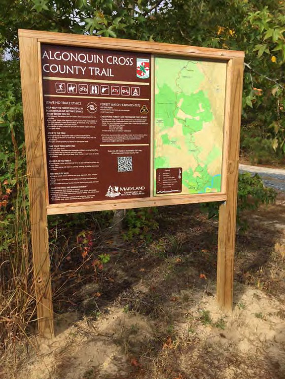
The Algonquin Cross County trail is 12.5-miles winding through the Chesapeake Forest and Pocomoke State Forest from Snow Hill Road (MD Route 12) south of Salisbury to Milburn Landing State Park. Parking areas are available at both trailheads, as well as at many points along the trail. This trail is ideal for those looking for a full day hike or a hike with an overnight stay at Milburn Landing. Parking at the Foster trailhead can accommodate large vehicles, such as trucks with horse trailers.
Chandler-Colburne Trail
Chandler Tract Trail
The Chandler tract has a total of 6.8 miles of trails with multiple loops. There are multiple trails designated by three different colors. The large loop (green) is 4.4 miles when starting from the south parking lot. An additional 1.7-mile blue trail loop begins and ends at the northeastern edge of the green loop. The 1.5-mile white trail begins at the south parking lot and terminates at Corker’s Creek. Parking for the Chandler tract is located off Worcester Highway (US 113) directly across from the Shad Landing area of Pocomoke River State Park.
Colburne Tract Trail
A 1.9-mile loop trail designated with red markers is located on the Colburne tract. A 0.9-mile white spur trail begins at the northeast corner of the red loop trail and leads towards Corker’s Creek. Parking for the Colburne tract is located off Onley Road approximately 1¼ miles from the intersection of Betheden Church Road.
Located between Snow Hill and Pocomoke City near the Shad Landing area of Pocomoke River State Park, this 8.5-mile network of single-track mountain bike trails winds through the Hudson and Tarr tracts of the Pocomoke State Forest. Trail sections and loops are marked using 4 different colored blazes (blue, green, white, and yellow). Parking is encouraged near the trail crossing on Blades Road. Although this trail is designed for non-motorized bike use, all compatible uses are supported.
Located adjacent to the Milburn Landing area of Pocomoke River State Park, this 3.7-mile loop trail traverses through upland pine and hardwood forests, as well as bald cypress bottomlands. Approximately 2.2 miles of the trail is shared with the Algonquin Cross County Trail. Horses and non-motorized bikes are allowed only on the shared portions of the trail. Parking is available on Camp Road, Nassawango Road, or in Pocomoke River State Park.
The Old Furnace Loop Trails are comprised of three trails of varying length and difficulty:
Red Furnace Loop - 6.2 miles
The longest of the three loop trails connects Furnace Town with the Algonquin Cross County Trail, with about half of the red loop concurrent with the Algonquin Cross County Trail. The red loop trail begins north of Furnace Town on Millville Road. A variety of unique forest communities are found on this trail, including inland sand dunes, low land swamps, and pine flats. This loop connects with both the Orange and Yellow Loops for additional opportunities.
Orange Furnace Loop - 3.9 miles
This loop begins at the intersection of the Algonquin Cross County Trail and Forest Road. The trail traverses through multiple forest types and ages. An additional 0.6 miles on Forest Road connects this loop.
Yellow Furnace Loop - 1.8 miles
The yellow loop trail is the shortest of the three loops. The yellow loop trail passes through a globally rare shortleaf pine and mixed oak forest community that developed on an inland sand dune. Different forest management activities have been used to improve and conserve this community, including seed tree harvests, prescribed fire, and commercial thinning.
This self-guided interpretive 0.6-mile loop trail is located approximately 4 miles west of Furnace Town near the intersection of Old Furnace and Old Beech Roads. The trail features interpretive waypoints that provide hikers with additional information about the various forest communities that are present on the Eastern Shore of Maryland.
