ALERT: Parking lots for the Appalachian Trail lots fill quickly. To avoid parking fines and/or towing please do not park outside of designated parking areas, on private property, and on the sides of roadways.
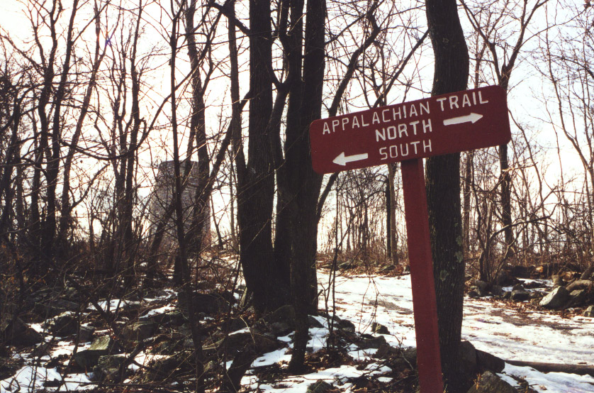
 The Appalachian Trail is a footpath across 2,168 miles of Appalachian Mountain ridgelines from Georgia to Maine. Almost 40 miles of the A.T., as it is affectionately known, cross Maryland, most of which follow the ridgeline of South Mountain.
2022 South Mountain Recreation Area Guide
(Published by the Herald-Mail Media)
Applachian Trail History
In 1921, Benton MacKaye, a Harvard-educated forester and self-styled philosopher, came up with a revolutionary idea: a linear park, extending from Georgia to Maine. Thousands of volunteers and many legislators helped make it happen. With the help of the Civilian Conservation Corps, the trail became a reality by 1937.
Trail users of all types enjoy the A.T. -- most just for short day hikes or an overnight backpacking trip. Others set out for weeks or months on the trail. Hundreds of people each year "thru-hike" the trail -- hike the entire length of the trail in one season. This takes four to six months, lots of planning and incredible strength of body and mind. Others who hike the entire trail may take many years to do it, as time, money and other constraints restrict them to doing a section at a time. Either way, it is a rewarding experience.
Maryland's 40 miles are considered fairly easy by A.T. standards, with only a 1,650 foot change in elevation from the low point at the Potomac River (250' elevation) to the high point at High Rock (1,900' elevation). There are few rocks and steep climbs compared to other parts of the trail in other states. However, it still offers plenty of challenges and some impressive scenery. For beginning backpackers, those getting in shape for longer trips and those with just a few days to spend on the trail, the entire length of trail in Maryland can be done in a four or five day backpacking trip. Trail shelters and backpackers' campgrounds are spaced approximately a day's hike apart.
Scenic overlooks and historic sites provide a great destination for those looking for a challenging day hike. Some popular day hikes include hiking from Greenbrier State Park to Annapolis Rock and Black Rock, from Greenbrier to Washington Monument State Park and from Gathland State Park to Weverton Cliffs.
Remember, the Appalachian Trail can be strenuous with steep slopes and difficult footing. Please follow safe hiking practices. For more detailed information about the A.T. in Maryland, you can purchase the Potomac Appalachian Trail Club's Maps 5 and 6 -- Appalachian Trail across Maryland and the Appalachian Trail Guide to Maryland and Northern Virginia -- at the Greenbrier visitor center or camper registration office.
Whether your goal is scenic beauty, history, bird and wildlife watching, exercising or just wanting to get away from it all, the A.T. offers all these things and much more. Help protect the beauty of the trail by following
Leave No Trace practices -- leave nothing but footprints, and take nothing from the trail but memories.
 Popular Day Hikes Along the Appalachian Trail
-
Destination: Annapolis Rock (elevation 1700')
- Access Point: Parking lot on Route 40, one-quarter mile east of Greenbrier. Follow blue blazed trail from parking lot to white blazed A.T. Turn right to go north on A.T.
Note: Parking is limited and becomes very crowded on weekends and holidays. - Difficulty: Moderate
- Distance: 2.2 miles
- Options for Return: Return by same trail to Route 40
- Highlights: Annapolis Rock offers a fine view of Greenbrier Lake and Cumberland Valley to the west. Continue north on A.T. one mile to Black Rock, which also offers a westward view.
-
Destination: Washington Monument (elevation 1600')
- Access Point: Parking lot on Route 40, one-quarter mile east of Greenbrier. Follow blue blazed trail from parking lot to white blazed A.T. Turn left to go south on A.T. (cross foot bridge over I-70).
Note: Parking is limited and becomes very crowded on weekends and holidays - Difficulty: Moderate
- Distance: 3 miles
- Options for Return: Return by same trail to Route 40 or leave a second car at Washington Monument State Park
- Highlights: The first monument to our nation's first president offers views to the east and west
-
Destination: Weverton Cliffs (elevation 750')
- Access Point: Gathland State Park
- Difficulty: Difficult
- Distance: 6 miles
- Options for Return: Return by same trail to Gathland or leave a second car at Weverton Road (an additional mile south of Weverton Cliffs on A.T.)
Highlights: Weverton Cliffs offers a view of the Potomac River and the area surrounding Harpers Ferry, West Virginia
